How hot water fuels the world’s most powerful hurricanes

Warm ocean water holds the key to the most powerful storms nature can throw our way.
Morning’s light revealed a thriving hurricane that seemed to grow more ominous with every new satellite image that beamed back to a nervous nation.
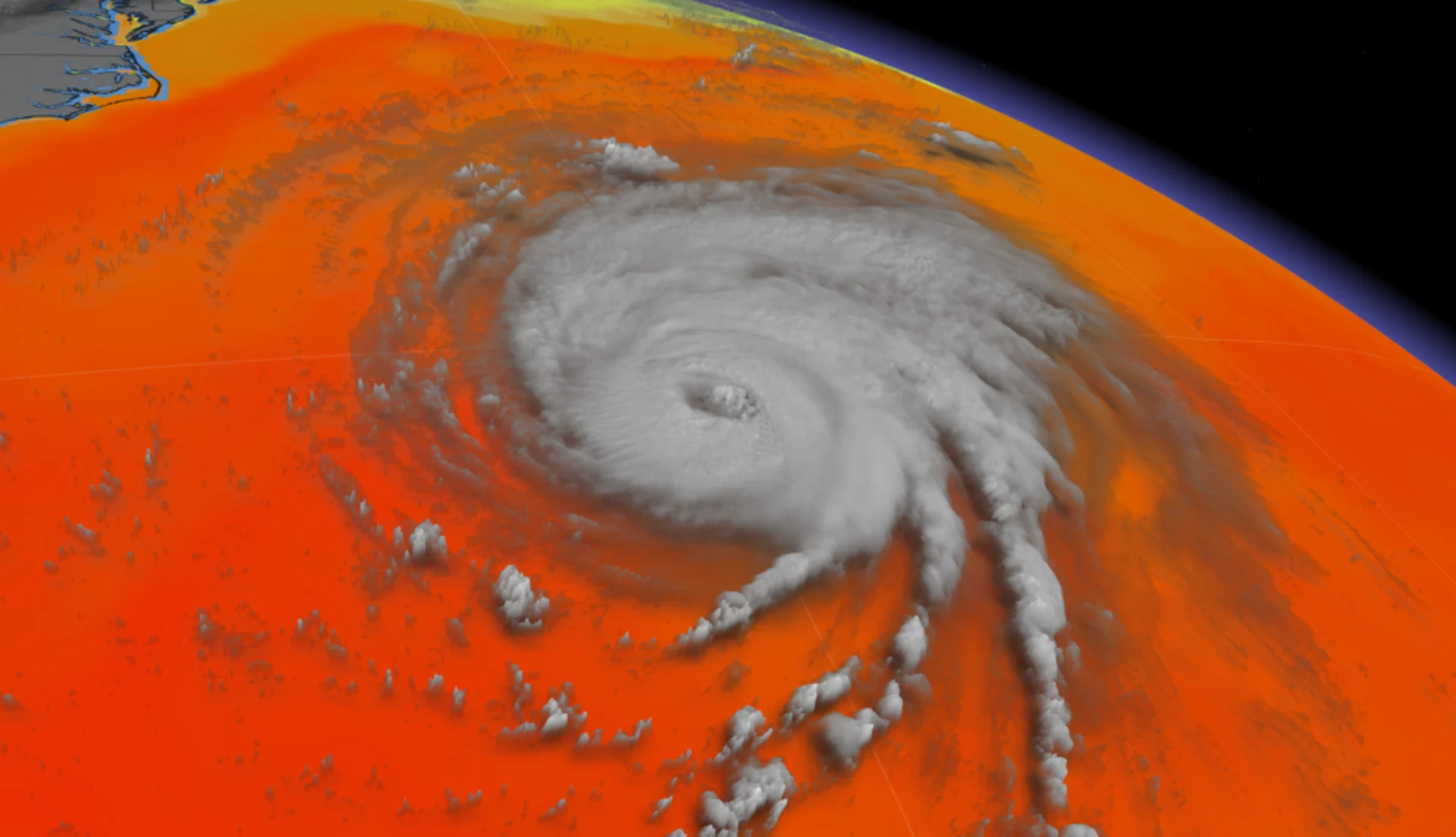
Hurricane Katrina swept across southern Florida on August 25, 2005, without missing a beat as it traversed the state’s swampy terrain. The storm’s intensity skyrocketed once it hit the steamy waters of the Gulf of Mexico.
The hurricane grew into a mammoth Category 5 over the following couple of days as it swirled toward the northern Gulf Coast. While the storm weakened a bit before landfall on August 29th, the hurricane still pushed a horrendous storm surge into the coast that triggered a yearslong humanitarian catastrophe.
Visit The Weather Network's hurricane hub to keep up with the latest on tropical developments in Canada and around the world
The hot water that Katrina traversed in the eastern Gulf of Mexico was the key to its sudden and devastating intensification, and it was a classic example of why meteorologists get nervous whenever a storm is about to encounter seas warm enough to bathe in.
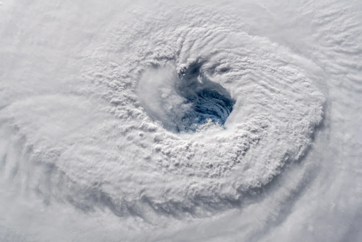
The eye of Category 4 Hurricane Florence in September 2018. Image courtesy ESA/NASA–A. Gerst.
Tropical cyclones form from clusters of healthy, persistent thunderstorms. These thunderstorms draw an immense amount of air from the lower levels and vent it high into the atmosphere, leaving less air—and lower air pressure—at the surface.
A tropical cyclone grows from a depression to a storm, then into a full-blown hurricane, as these long-lived thunderstorms gather strength around the centre of low pressure.
The thunderstorms at the centre of the storm intensify when they pass over warmer waters and weaken when they encounter cooler waters.
But how does the temperature of the water actually fuel or destroy the storm? Unlike lake-effect snow, tropical cyclone intensity isn’t as simple as a temperature difference between the air and the water itself.
SEE ALSO: How hot water fuels the world’s most powerful hurricanes
CHECK IT OUT: Dive into a hurricane’s eyewall
Understanding how warm waters fuel intense hurricanes starts with your sweat—really!
We sweat when we’re hot because the water evaporating off the surface of our skin helps to lower our body temperature. Evaporation cools us off because water absorbs heat when it transitions from its liquid state to water vapour. This vapour then releases its heat when it condenses back into liquid water.
The seesaw between absorbing and releasing heat is known as latent heat release, and it’s the key to the intensity of a hurricane.
High winds in a developing storm scrape across the surface of the sea and evaporate some of that warm ocean water, transferring that warmth into water vapour in the air. This vapour travels up into the thunderstorms and condenses into clouds, releasing its heat and giving the storm the instability it needs to thrive.
It’s an ugly cycle that powers some of the world’s most intense hurricanes.
Warmer waters give off more heat through evaporation, which leads to stronger thunderstorms, which in turn intensifies the tropical cyclone and its winds. Higher winds lead to even more evaporation, prompting more heat release into the storm, continuing the feedback cycle that can help a storm grow into a scale-topping monster as it churns through the tropics.
This process only stops when the storm’s structure is disrupted—by wind shear, dry air, or interaction with land—or when it encounters cooler waters. Lower sea surface temperatures don’t give off enough heat to fuel the thunderstorms around the centre of a tropical cyclone, forcing it to lose strength in a hurry.


